Terms and Conditions
By entering this website you are deemed to have accepted the terms and conditions laid out below. If you find these terms unacceptable, you must leave the website immediately.
1. The content of this website is the sole property of Spatial Geomatics Limited. All intellectual property rights existing in this site (including without limitation any copyright and design right) belong exclusively to Spatial Geomatics Limited.
You may download pages of this website to a local disk or other storage media and you may print off extracts of this site and share both within your organisation strictly on the basis that you do not do so for profit and on the condition that Spatial Geomatics Limited’s copyright notice is preserved at all times.
2. Otherwise, reproduction of part or all of the contents of this website in any form is prohibited unless for personal use. None of the content of this website may be copied or otherwise incorporated into or stored on any other website, electronic retrieval system, publication or other work in any form whatsoever. You may not frame any part of this website. Spatial Geomatics Limited’s copyright notice must remain on all reproductions of material downloaded from this site.
3. Whilst the directors of Spatial Geomatics Limited have taken every care to ensure that the information on this website is accurate and up to date, no warranties express or implied are given as to the accuracy of the information contained on the website. No action should be taken or omitted in reliance of any information or advice placed on the website. In particular, the directors of Spatial Geomatics Limited accept no liability for any service descriptions or photographic representations and users are advised to make enquiries with Spatial Geomatics Limited if they have any specific requirements.
4. The directors of Spatial Geomatics Limited shall not be liable for any loss or damage arising out of the use of any of the information on this website. Whilst every effort has been made to ensure that this website is virus free, we recommend that you take precautions against infection. The directors of Spatial Geomatics Limited cannot accept any liability for damage sustained as a result of the transmission of viruses, worms, trojans or any other malicious content.
5. Unless otherwise specified, the materials on this website are directed at and are intended solely for use by those accessing the website from the United Kingdom mainland. The directors of Spatial Geomatics Limited make no representation or warranty that any product, service or information referred to or contained in this website are appropriate for use in other locations or jurisdictions. Those who choose to access this site from other locations or jurisdictions are responsible for compliance with any applicable local laws.
6. These exclusions of liability shall not apply in respect of death or personal injury caused by the negligence of the directors of Spatial Geomatics Limited or any of its employees or agents. These Terms of Use shall be construed in accordance with and governed by English law. If any provision of these Terms of Use shall be deemed unenforceable or invalid then that provision shall be deemed severable from the remaining terms and those remaining terms shall be valid and enforceable to the fullest extent permitted by law. For the avoidance of doubt, nothing in these terms shall confer on any third party any benefit or the right to enforce any term or terms. Unless a contrary intention is expressed, nothing in this website shall be deemed to create a binding contract between the directors of Spatial Geomatics Limited and any users of the website.
7. Any information acquired by the directors of Spatial Geomatics Limited through your use of this website will be processed in accordance with the Data Protection Act 1998 and any associated Statutory Instruments, Codes of Practice and subsequent Acts of Parliament. You should be aware that because of the global nature of the internet, your personal data is likely to be temporarily stored in jurisdictions beyond the EEA whilst in transmission. For further details please see our GDPR 2018 Privacy Notice.
- If you require any further information, please contact us.
Can’t find what you’re looking for?
Get in touch with us and we will do our very best to help with any queries you may have…
FAQ’s
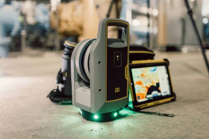
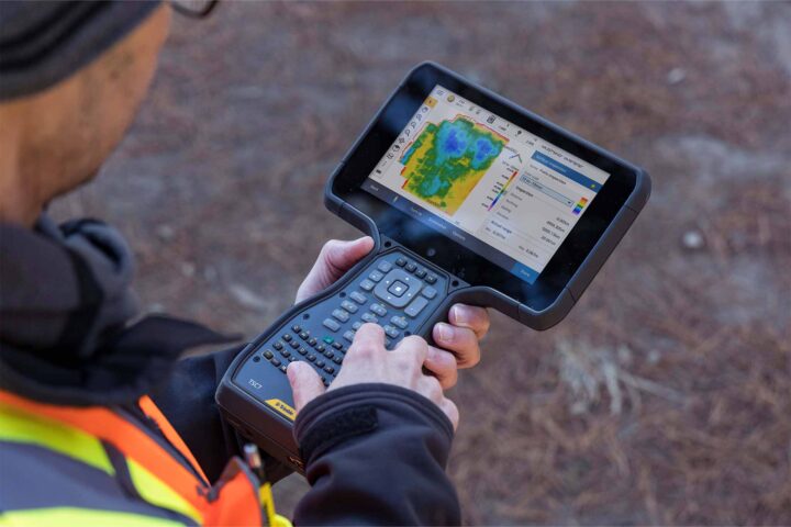
View allUsing an advanced high-speed laser surveying tool, our surveyors are able to capture vast amounts of coordinate and image data. The scanner ‘records’ a 3D picture of a site, structure or construction by measuring angles and distances to points on visible surfaces. It also records the colour intensity of these points and can be set to measure higher or lower levels of detail and complexity. Once all angles are captured, the data is gathered and processed by software that produces 3D deliverables. This gives us both real pictures and raw data for further processing.
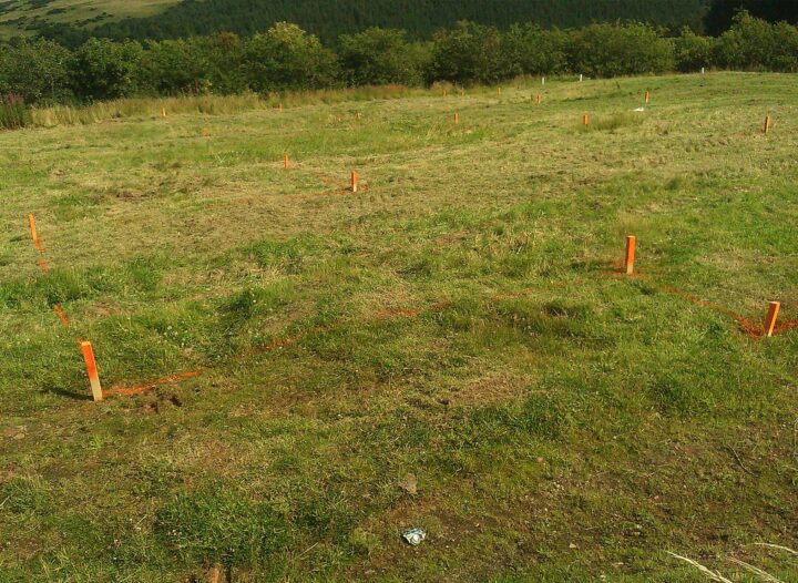
Surveying within the railway environment requires specialist techniques as the modern railway is a dangerous place with safety issues often dictating the need for non-contact measurement using instrumentation such direct reading total stations, laser scanning as well as conventional equipment on line possessions at night. At Spatial Geomatics we carry out topographic surveys from existing level crossing that require a high degree of accuracy, monitoring of embankments and surveys of railway infrastructure and associated projects.
As a progressive survey company, Spatial Geomatics constantly monitors and utilises the latest surveying technology. GPS offers a complete solution for advance surveying including real time kinematic (RTK) and static surveying. The Trimble GPS combines advanced receiver technology and a proven system design to provide maximum accuracy and productivity. The Trimble GPS can be used as a wireless base station or rover.
Spatial Geomatics is equipped to carry out in-shore hydrographic surveys of reservoirs, lakes, canals, rivers and estuaries. Surveys are primarily undertaken with an array of echo-sounders and GPS equipment. Our hydrographic survey staff are all fully trained in boat handling and safety techniques and the boats are all launched from trailers.
Let’s talk or fill in our enquiry form today
Have you found what your looking for? Or simply require more information? Don’t hesitate to get in touch today or fill in our enquiry form, and we can arrange a call back.
Telephone: 01661 823000
Email: info@sgl.uk.com
"*" indicates required fields


We strive to offer the best possible surveying services & competitive quotations for all your needs.


