Everything You Need to Know About Our Utility Surveys & Services in Newcastle, York, Leeds, Carlisle, North Yorkshire and Durham
At Spatial Geomatics Ltd (SGL), we provide comprehensive utility survey services across Newcastle, York, Leeds, Carlisle, North Yorkshire, and Durham. With over 35 years of experience, our expert team delivers precise, reliable, and timely surveying solutions tailored to meet your project’s unique requirements.
What Is a Utility Survey?
A utility survey identifies and maps the location of underground utilities such as water, gas, electricity, and telecommunications infrastructure. Conducting a utility survey during the planning and design phase of a project helps prevent accidental utility strikes, reduces delays, and ensures compliance with safety regulations.
Our Survey Techniques
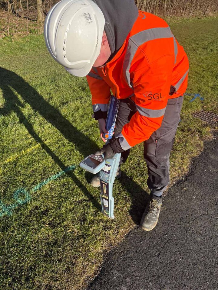
We employ advanced technologies to accurately detect and map underground utilities:
- Radio Detection: Utilizes electromagnetic signals to locate metallic utilities.
- Ground Penetrating Radar (GPR): Employs high-frequency radio waves to detect both metallic and non-metallic utilities, including plastic water and gas pipes, and clay drainage pipes.
These methods allow us to detect services up to 3 meters below ground, providing a comprehensive understanding of the subsurface environment.
Compliance with Industry Standards
Our utility surveys adhere to the British Standards Institution PAS 128:2014 specification for underground utility detection, verification, and location. We collaborate with clients to determine the appropriate Survey Category Type (D to A) and methodologies to ensure the survey meets the required accuracy levels.
Why Choose Spatial Geomatics Ltd?
- Experienced Professionals: Our senior staff possess over 35 years of experience in the surveying profession, ensuring reliable and efficient results.
- Advanced Technology: We utilize the latest robotic instruments, GPS systems, and software for superior accuracy.
- Nationwide Capability: Serving clients across Newcastle, York, Leeds, Carlisle, North Yorkshire, and Durham, as well as nationwide.
- Client-Centric Service: We tailor every project to meet your exact specifications and objectives.
Our Utility Survey Process
- Initial Consultation: We discuss your project requirements to understand the scope and objectives.
- Site Assessment: Our team conducts a thorough site visit to evaluate conditions and plan the survey approach.
- Survey Execution: Using advanced detection methods, we locate and map underground utilities.
- Data Analysis and Reporting: We analyse the collected data and provide detailed reports, including CAD drawings and 3D models, to support your project planning.
- Post-Survey Review: We discuss the findings with you to ensure all requirements are met and address any concerns.
Serving Key Locations
- Newcastle: Our base in Ponteland enables us to efficiently serve the Newcastle area with timely and accurate utility surveys.
- York: We offer comprehensive utility survey services to support developments and infrastructure projects in York.
- Leeds: Our team is equipped to handle utility surveys for both urban and rural projects in Leeds.
- Carlisle: We provide reliable utility survey services to clients in Carlisle, ensuring safe and efficient project execution.
- North Yorkshire: Serving the diverse needs of North Yorkshire, we deliver tailored utility survey solutions across the region.
- Durham: Our utility survey services in Durham support a wide range of construction and development projects.
Contact Us
For more information or to request a quotation, please visit our Utility Survey Services page.
Trust Spatial Geomatics Ltd to provide accurate and reliable utility survey services that ensure the success and safety of your projects.