Company Policies
Mission Statement
The mission of Spatial Geomatics is to prosper as a professional surveying company by offering a service in a manner that aims to exceed our customer’s expectations and continually enhance the company’s personnel expertise and resources.
Quality
Spatial Geomatics is totally committed to quality and will always put the customer first in all that we do. We have a quality system that is continuously monitored and updated to ensure that all services and products offer the highest standard of quality and reliability.
Health and Safety
Spatial Geomatics is committed to providing working conditions that are safe and healthy for all employees. All operations shall be carried out so that so far as reasonably practicable the Health, Safety or Conditions of any person or property will be protected.
Environmental Policy
Spatial Geomatics recognises its role in achieving environmental best practice and continuous improvement in its business activities. The company also recognises its responsibility for protecting the environment from further damage by managing energy efficiently and minimising its waste production.
Equal Opportunnities
Spatial Geomatics is an equal opportunities employer and will apply objective criteria to assess potential suitability for jobs. We aim to ensure that no job applicant or employee receives less favourable treatment on the ground of race, colour, nationality, religion, ethnic or national origins, age, gender, marital status, sexual orientation or disability.
Can’t find what you’re looking for?
Get in touch with us and we will do our very best to help with any queries you may have…
FAQ’s
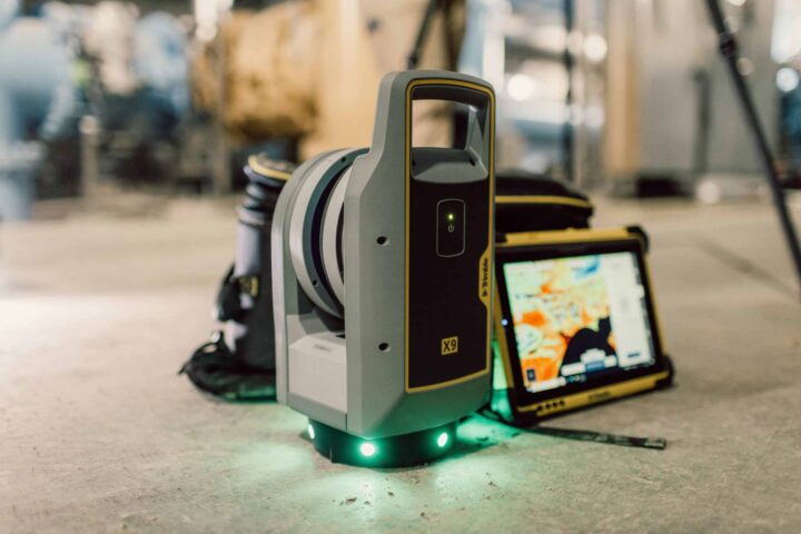
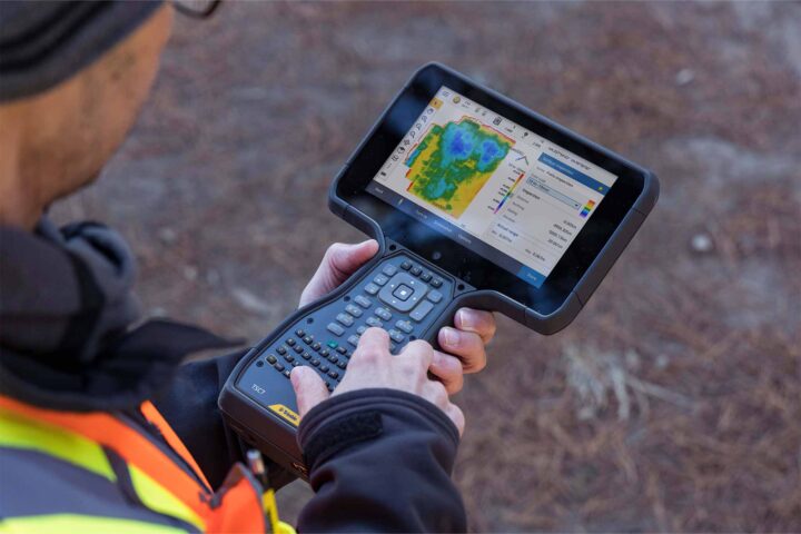
View allUsing an advanced high-speed laser surveying tool, our surveyors are able to capture vast amounts of coordinate and image data. The scanner ‘records’ a 3D picture of a site, structure or construction by measuring angles and distances to points on visible surfaces. It also records the colour intensity of these points and can be set to measure higher or lower levels of detail and complexity. Once all angles are captured, the data is gathered and processed by software that produces 3D deliverables. This gives us both real pictures and raw data for further processing.
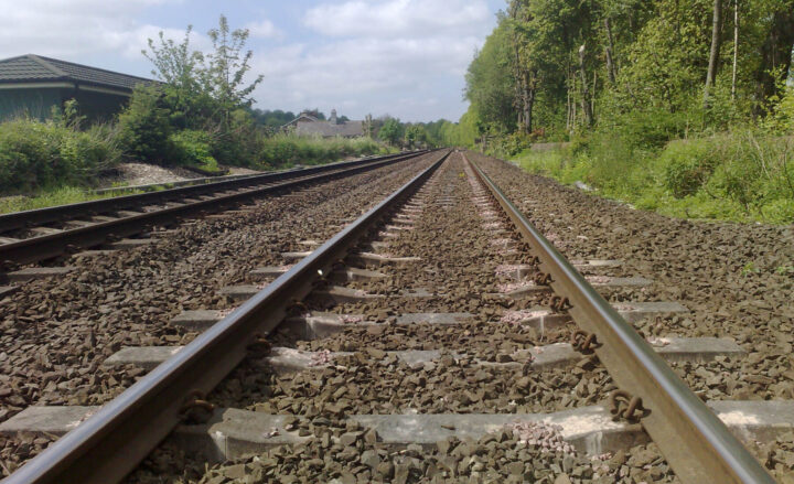
Surveying within the railway environment requires specialist techniques as the modern railway is a dangerous place with safety issues often dictating the need for non-contact measurement using instrumentation such direct reading total stations, laser scanning as well as conventional equipment on line possessions at night. At Spatial Geomatics we carry out topographic surveys from existing level crossing that require a high degree of accuracy, monitoring of embankments and surveys of railway infrastructure and associated projects.
As a progressive survey company, Spatial Geomatics constantly monitors and utilises the latest surveying technology. GPS offers a complete solution for advance surveying including real time kinematic (RTK) and static surveying. The Trimble GPS combines advanced receiver technology and a proven system design to provide maximum accuracy and productivity. The Trimble GPS can be used as a wireless base station or rover.
Spatial Geomatics is equipped to carry out in-shore hydrographic surveys of reservoirs, lakes, canals, rivers and estuaries. Surveys are primarily undertaken with an array of echo-sounders and GPS equipment. Our hydrographic survey staff are all fully trained in boat handling and safety techniques and the boats are all launched from trailers.
Let’s talk or fill in our enquiry form today
Have you found what your looking for? Or simply require more information? Don’t hesitate to get in touch today or fill in our enquiry form, and we can arrange a call back.
Telephone: 01661 823000
Email: info@sgl.uk.com
"*" indicates required fields


We strive to offer the best possible surveying services & competitive quotations for all your needs.


