Utility Survey
About our Utility Surveys
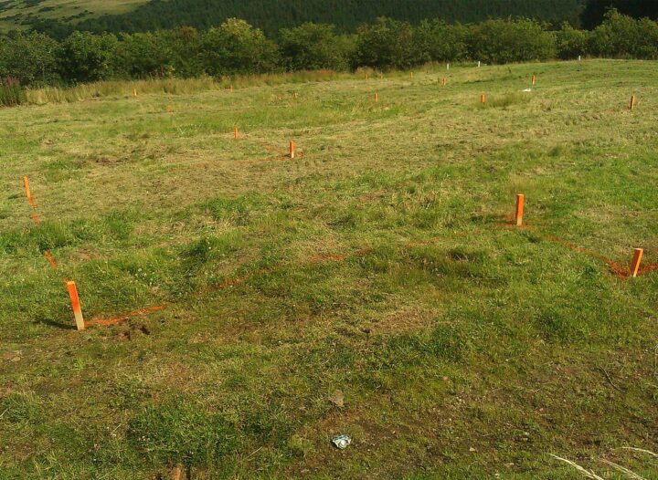
Utility Survey Services across Newcastle & the UK
Underground infrastructure surveys are increasingly used during the project design stage so that appropriate measures are taken to avoid service conflicts and quantify the scope of any service re–alignment works.
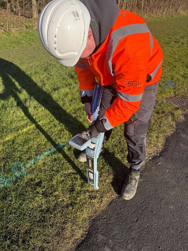
We employ the techniques of Radio Detection and Ground Penetrating Radar to locate utilities. The depth of investigation will depend on the conditions of the site. In general, Radio Detection and ground penetrating radar techniques will detect services up to 3 meters below the ground services.
Radio detection and ground penetrating radar techniques are also used to confirm and complement existing as–built drawings and other records prior to development and excavation operations.
Radio detection techniques are unable to detect non-metallic buried services including plastic water and gas pipes and clay drainage pipes. To overcome this potentially hazardous sitution, we often combine the use of Radiodetection with Ground Penetrating Radar (GPR). GPR is able to detect non metallic as well a metallic pipes. It will also give an indication of the location and depth of buried services but will not identify them.
British Standards Institution PAS 128, Specification for underground utility detection, verification and location is the new publicly available specification document which allows the utility survey industry to deliver its services to a recognised level of accuracy.
Typically Spatial Geomatics and the client will have a discussion/meeting to discuss the appropriate PAS 128 Survey Category Type (D to A) and the particular Survey Methodologies to be used. Each project is different and there are many combinations and factors that may need to be discussed. We will advise the client on the best and most appropriate methods based on the information given.
Post survey, a discussion and/or meeting takes place so that we can explain to the client the accuracies achieved and any limiting factors. At this point it may be appropriate to suggest other methods of survey to achieve greater levels of accuracy in areas of concern/strategic project importance.
- For more information on PAS 128, click here.
Can’t find what you’re looking for?
Get in touch with us and we will do our very best to help with any queries you may have…
FAQ’s
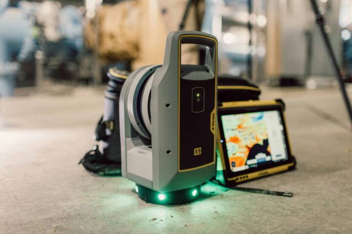
View allUsing an advanced high-speed laser surveying tool, our surveyors are able to capture vast amounts of coordinate and image data. The scanner ‘records’ a 3D picture of a site, structure or construction by measuring angles and distances to points on visible surfaces. It also records the colour intensity of these points and can be set to measure higher or lower levels of detail and complexity. Once all angles are captured, the data is gathered and processed by software that produces 3D deliverables. This gives us both real pictures and raw data for further processing.
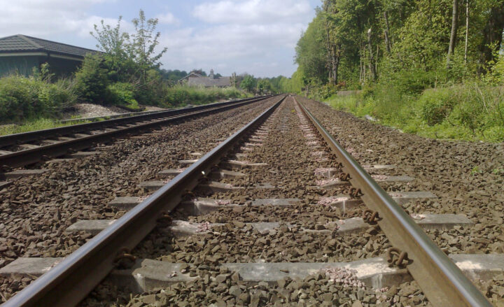
Surveying within the railway environment requires specialist techniques as the modern railway is a dangerous place with safety issues often dictating the need for non-contact measurement using instrumentation such direct reading total stations, laser scanning as well as conventional equipment on line possessions at night. At Spatial Geomatics we carry out topographic surveys from existing level crossing that require a high degree of accuracy, monitoring of embankments and surveys of railway infrastructure and associated projects.
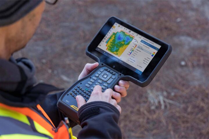
As a progressive survey company, Spatial Geomatics constantly monitors and utilises the latest surveying technology. GPS offers a complete solution for advance surveying including real time kinematic (RTK) and static surveying. The Trimble GPS combines advanced receiver technology and a proven system design to provide maximum accuracy and productivity. The Trimble GPS can be used as a wireless base station or rover.
Spatial Geomatics is equipped to carry out in-shore hydrographic surveys of reservoirs, lakes, canals, rivers and estuaries. Surveys are primarily undertaken with an array of echo-sounders and GPS equipment. Our hydrographic survey staff are all fully trained in boat handling and safety techniques and the boats are all launched from trailers.
Let’s talk or fill in our enquiry form today
Have you found what your looking for? Or simply require more information? Don’t hesitate to get in touch today or fill in our enquiry form, and we can arrange a call back.
Telephone: 01661 823000
Email: info@sgl.uk.com
"*" indicates required fields


We strive to offer the best possible surveying services & competitive quotations for all your needs.


