Everything You Need to Know About Spatial Geomatics’ GPS Survey Services in the North East
Accurate location data is the foundation of successful construction, engineering, and land development projects. For clients across Newcastle, Durham, Carlisle, Northumberland, Cumbria, and the wider North East, Spatial Geomatics Ltd (SGL) provides precise and reliable GPS Survey services that ensure every project starts on solid ground.
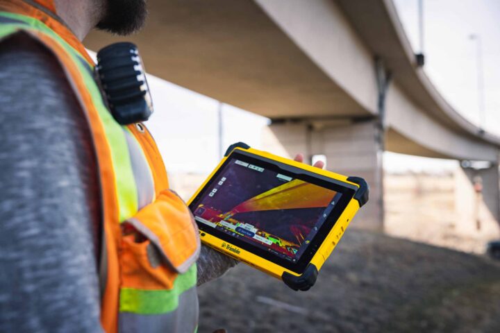
What Is a GPS Survey?
A GPS (Global Positioning System) survey uses satellite technology to determine precise locations on the earth’s surface. Unlike traditional surveying methods, GPS surveys can cover large areas quickly, providing accurate coordinates for points, boundaries, and structures.
These surveys are essential for tasks such as:
- Establishing property boundaries and site layouts
- Monitoring construction progress
- Mapping infrastructure projects
- Supporting civil engineering and environmental studies
At SGL, we combine GPS technology with expert surveying techniques to deliver highly accurate data tailored to each project’s needs.
Why Choose Spatial Geomatics?
1. Advanced GPS Technology
SGL employs state-of-the-art GPS receivers capable of sub-centimetre accuracy. Our systems are ideal for large-scale site surveys as well as detailed engineering applications. For projects requiring extreme precision, we integrate GPS data with total station measurements, laser scanning, and drone surveys, ensuring a comprehensive and reliable dataset.
2. Experienced Surveying Team
With over 35 years of experience, our surveyors have extensive knowledge of the North East region. From urban developments in Newcastle to remote rural sites in Northumberland and Cumbria, we understand the challenges of diverse terrains and can adapt our approach accordingly.
3. Flexible and Customised Solutions
Every project is unique, and so is every GPS survey we conduct. SGL works closely with clients to determine the specific data required, delivering outputs in various formats, including CAD files, GIS-compatible datasets, and detailed survey reports.
Applications of GPS Surveys
GPS surveys are highly versatile and support a wide range of applications:
- Construction and Civil Engineering: Set out precise coordinates for foundations, utilities, roads, and bridges.
- Land Development and Planning: Accurately map land parcels and boundaries for planning submissions.
- Infrastructure Monitoring: Track movements or changes in existing structures over time.
- Environmental Studies: Map terrain features, watercourses, and ecological sites with precise positioning.
- Integration with Other Survey Services: GPS data can be combined with topographic, drone, and measured building surveys for a complete site model.
Serving Newcastle, Durham, Carlisle, Northumberland, Cumbria, and the North East
Spatial Geomatics is proud to provide GPS survey services across the North East. Our local knowledge ensures surveys are conducted efficiently and in compliance with regional regulations, saving clients time and reducing project risks. Whether your site is in the heart of Newcastle, a historic property in Durham, or a remote area in Cumbria, SGL delivers accurate GPS data that supports every stage of your project.
Get in Touch
For reliable, precise, and professional GPS Survey services in Newcastle, Durham, Carlisle, Northumberland, Cumbria, or anywhere in the North East, contact Spatial Geomatics Ltd today. Our team is ready to provide tailored solutions that meet your project’s unique requirements.
Learn more or request a quote by visiting our GPS Survey services page.